

Activity Summary | Weather |
Date 16th November 2025 Distance: 8.24 km Ascent: 894m Max Altitude: 978m Time to summit: 2:46 Total time: 5:55 | Clear Temperature 3 ℃ Humidity 89% Feels like 2 ℃ Wind Speed 6.5 km/h Wind Direction ENE |
Equipment Used
- SRH770 2m antenna
- Yaesu FT65
- PoLo logging app on iPad mini
Parking Location What3Words
///sunflower.punters.acrobaticActivation Report
The Lake District used to be my regular playground, since my teenage years, until about 15 years ago when life got in the way. It had been 17 years since I last climbed Scafell Pike, and it was time to put that right.
On Sunday morning, I left our holiday cottage at first light, and arrived at the National Trust Lakeside carpark at 7:45 am. The carpark location is at NY1822 0749. Parking is free for National Trust members if you scan your membership card to obtain your ticket.
It was just after 8am when I set off, from a surprisingly busy carpark. I set into a steady pace as I started the long ascent. It always amuses me on walks like this, with a steepish ascent, to see some people race past, only to catch them up, because they have stopped for rest.

After crossing the stream, the path steepens, and I began climbing some steps. After some more steady plodding, I eventually arrived at Hollow Stones, here the terrain opens up and gradient becomes less steep. Soon after climbing over the top of Pikes Cragg, I started to notice black ice on the rocks and even a bit of frozen snow in places. Some care was needed on the final approach to the summit, as it was slippy in places.
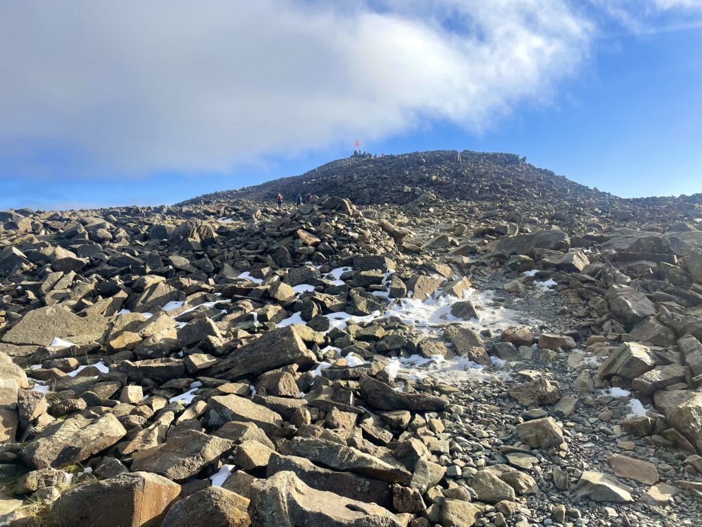
For those who may not know, Scafell Pike was given to the National Trust to serve as a lasting memorial for all those who lost their lives during the First World War. So it felt particularly poignant to see the ‘Lest We Forget’ and the Union Jack flags, flying as I approached the summit. I was soon climbing up to the summit cairn to take in the view. It was difficult to take a 360 video, due to other people on the large round cairn. I managed to dance around people to get the best video I could under the circumstances.
I found myself a suitable rock to use as a shack desk, not far from the summit cairn. Although, I had only alerted for 2m, I did have my QMX with me. However, given how busy the summit was and the cold temperatures, I decided to stay with a 2m only activation.

I was using the SRH770 antenna on the FT65 radio, with an external hand microphone. I put a spot out, and first in the log was Mark, G7SXr in West Yorkshire. Followed by Mark, G5TEA, in Windermere, giving his new callsign an airing. Longest distance was Frank, GW1OFA in Pembrokeshire, at 289km. Don, GW0GLP in Ceredigion was a similar distance at 274km, but he sounded like he was 30km away. I managed three summit to summits, including Jake, M0PVC on Illgill Head, G/LD-029. This was perfect as I plan to activate Illgill later in the week, and so will be another complete.

I had a really enjoyable activation with the 10 points bringing my total activator points to 518, with 301 of those points achieved this year. It maybe strange, but it always feel like I have come home, when I am on a Lake District summit, so I will be back.

As I started to make my way down, I had a Mr Bean moment. I was just warning two lads about the ice and slippy rocks, as I said the slippy, my legs went into a Scooby Doo running on the spot motion. I could see the look of horror on one of the lads faces. Somehow, I managed to anchor myself with my walking poles, and disaster was averted.
I continued my descent, although it felt a bit of a slog. I am sure it took me nearly as long to get down to the car as it did climbing up. I was back at the car for 2pm, heading back to our cottage, where a much needed bowl of stew was waiting for me.
The interactive map below shows a track of the route taken. You can zoom in or out to change the scale. The map can also be shown in full screen. The GPX track can also be downloaded using the link below the map.
Further information can be found on the SOTA resource page for the summit