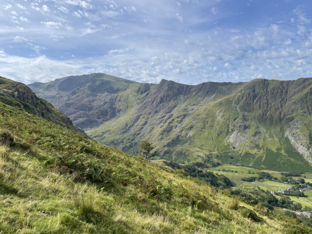
SOTA Activation, Yr Wyddfa – Snowdon GW/NW-001

Summits On The Air 10 point summit

Activity Summary

Weather

Date 26th September 2025

Distance: 15.19 km

Ascent: 966m

Max Altitude: 1085m

Moving time: 4:32

Total time: 6:01

Clear

Temperature 10 ℃

Humidity 82%

Feels like 11 ℃

Wind Speed 9.0 km/h

Wind Direction SE

Activation Summary

I had been waiting for the busy summer season to finish before attempting Yr Wyddfa (Snowdon), as I am not keen on busy summits. I noticed a window of good weather had presented itself, and so on Friday 26th September, I seized the opportunity to activate Yr Wyddfa.
My chosen route, was out and back on the Llanberis Path. I arrived at the carpark opposite the mountain railway station in Llanberis at about 8:40 a.m. As I was paying for my parking, I was a little surprised at the Β£14 daily parking charge, but it is still cheaper than the Pen y Pass car park. If time allows I think the Sherpa / park and ride bus is an excellent parking option for many of the summits in this area.

I was ready to go and on my way at just after 9 am, crossing over the main road and heading up Victoria Terrace, where you immediately pick up signs for the Llanberis Path. This route is very much a straight forward, steady plod. It was a bit surreal to see the mountain train, as it passed up and down the mountain, but it made an interesting addition to the scenery.
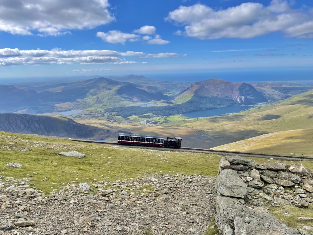
The train heading to the summit

It took about 2 hours and 40 minutes to reach the summit. As I walked up the steps to the summit stone, I was lucky, as there were only two ladies waiting in front of me. I patiently waited for them to finish their photo session. As soon as they had finished I hopped up to the summit, to start my 360 video. Comically, as I was videoing, another couple jumped up and seemed somewhat putout that I was moving and got into their selfie slot.

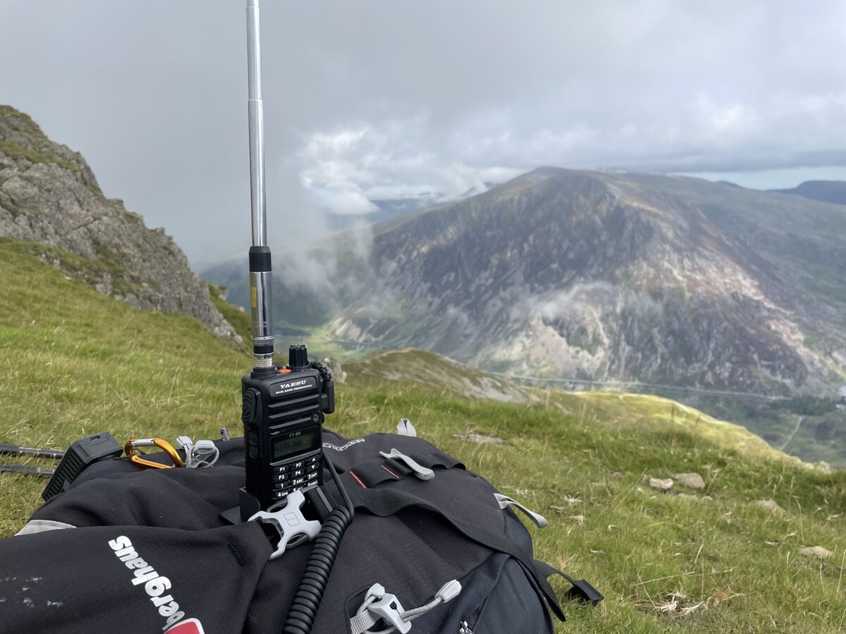
As it wasn’t too busy on the summit, I had setup just below the summit cairn sitting on the edge. I started on 2m’s using the FT65 with the SRH770 antenna, and to my surprise when I turned the radio on, 2m was really busy. Tuning through the band I heard Simon GW4TJC on Garn Boduan, GW/NW-066 and managed to get the summit to summit (S2S) in the log. I found a clear frequency, and only got as far as checking if the frequency was clear, before a mini pileup ensued. First was another S2S with M7GTU on Red Screes, G/LD-017, followed by some regular callers. I am always grateful for the support from the regulars, especially Don, GW0PLP who I realised later, had spotted me.

Unfortunately, mid pile up I was suddenly surrounded by a large crowd of people, I can only assume that a train had just arrived at the summit. I had to grab my gear and move about 10 metres before continuing to work through the callers. As the calls quietened down, Gerald MW0WML called in with another S2S from Allt Fawr, GW/NW-025. I had one last tune through 2m, hoping get a couple more S2S but it seems I was too late and had missed the other GW summits, that had be active earlier. I had spoken earlier to Oliver M7OTJ/P, as he was ascending Shining Tor and so called into his activation for my last QSO and bring the S2S count to 4.

In all I managed 17 QSO’s and 4 S2S on 2m, including Northern Ireland.
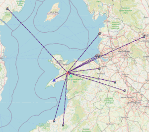
QSO Map

Equipment Used

  • Yaesu FT65
  • SRH770 (BNC) 2m antenna
  • PoLo logging app on iPad mini

Parking Location What3Words

///beak.cloak.avoiding

The interactive map below shows a track of the route taken. You can zoom in or out to change the scale. The map can also be shown in full screen. The GPX track can also be downloaded using the link below the map.

Download file for GPS

Once I had packed away, it would have been rude not to go and have a coffee in the cafe. This was actually my first time on the summit that 1. I have had a clear view and 2. That the cafe has actually been open. I was amazed how big the cafe actually was inside and how well stocked it was. After a coffee and a warm up I descended back down to Llanberis.
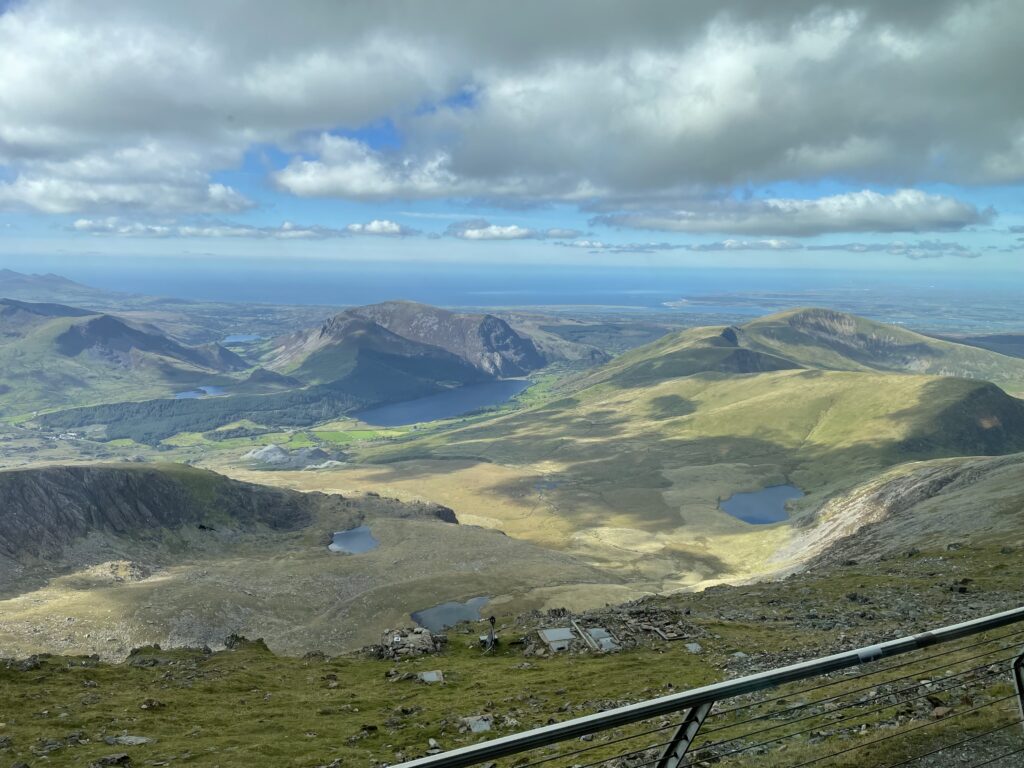
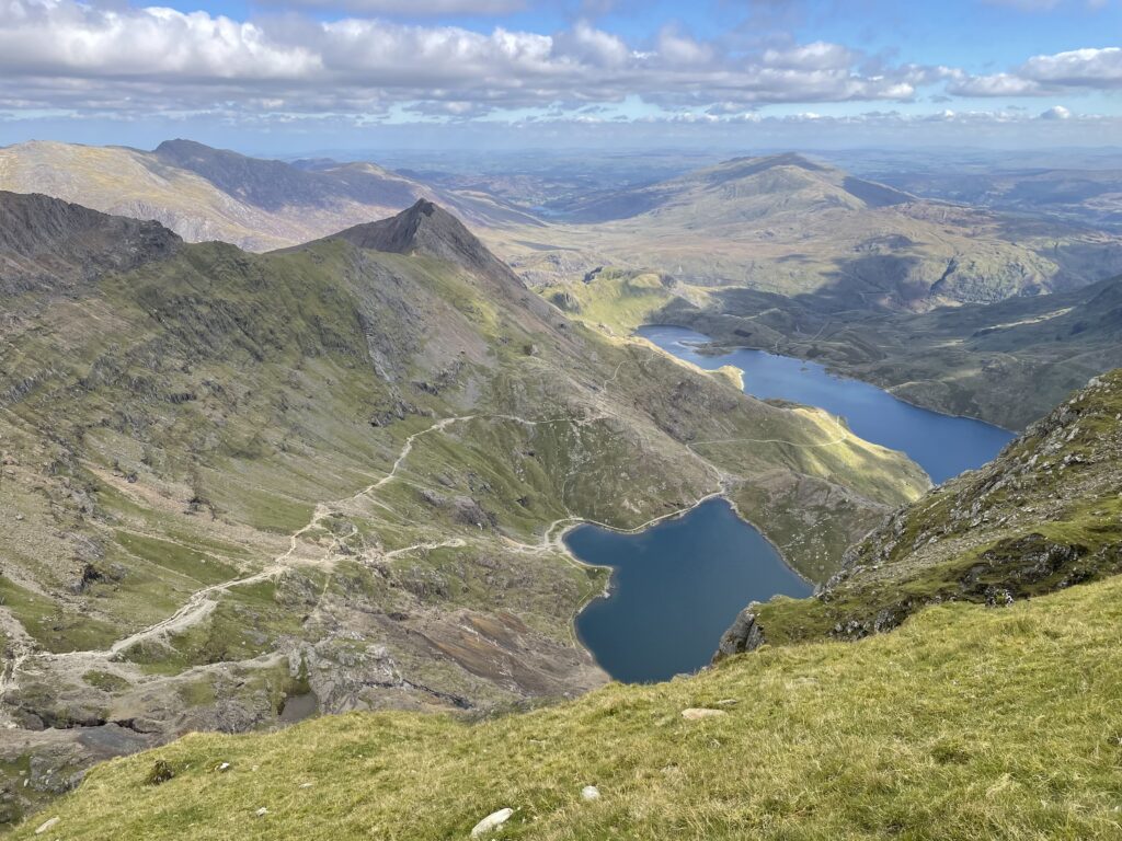
View from the Cafe
Looking down onto the Pyg and Miners Tracks

SOTA Activation Moelwyn Mawr GW/NW-016

Summits On The Air 6 point summit

Activity Summary

Weather

Date: 2nd September 2025

Distance: 7.6 km

Ascent: 519 m

Max Altitude: 770 m

Moving time: 2:58

Total time: 4:28

Cloudy

Temperature 12 ℃

Humidity 93%

Feels like 12 ℃

Wind Speed 6.7 km/h

Wind Direction S

Activation Summary

For today’s walk I was heading up Moelwyn Mawr, taking the route through the old Wrysgan quarry, near Tanygrisiau.
There is a carpark at SH 68289 45433, and although there was plenty of parking spaces at 9am, the carpark was full on my return at about 1:30 pm as its not the biggest carpark.

Fortunately for today’s walk I was using a route that I had downloaded from SOTL.AS, thanks to G4JTC for uploading the route. Without a GPS navigation device with the loaded route, navigation through the quarry would have been tricky in places as the route was not always obvious. Once the route starts the ascent up through the quarry, the path does become steep, care would be needed in wet weather as the wet slate can become very slippy. Fortunately, although rain showers were forecast the weather remained dry for the ascent.

Walking past the old quarry workings you can only imagine how busy this quarry would have been in its day. These slate mines were a major industry in this area from the late 1700’s until the 1970’s. On this walking route you can see the old tunnel entrances to the mines, some more visible than others.

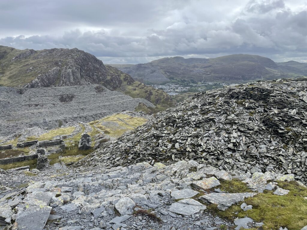
Old Quarry building and waste slate dominate the landscape
One of the old mine tunnel entrances

Once clear of the quarry the path is straightforward and the summit soon comes into view.
I was surprised how many people were crossing the summit as I approached, but I soon learned that it was the Dragons Back ultra trail run and today part of the route crossed the summit of Moelwyn Mawr.

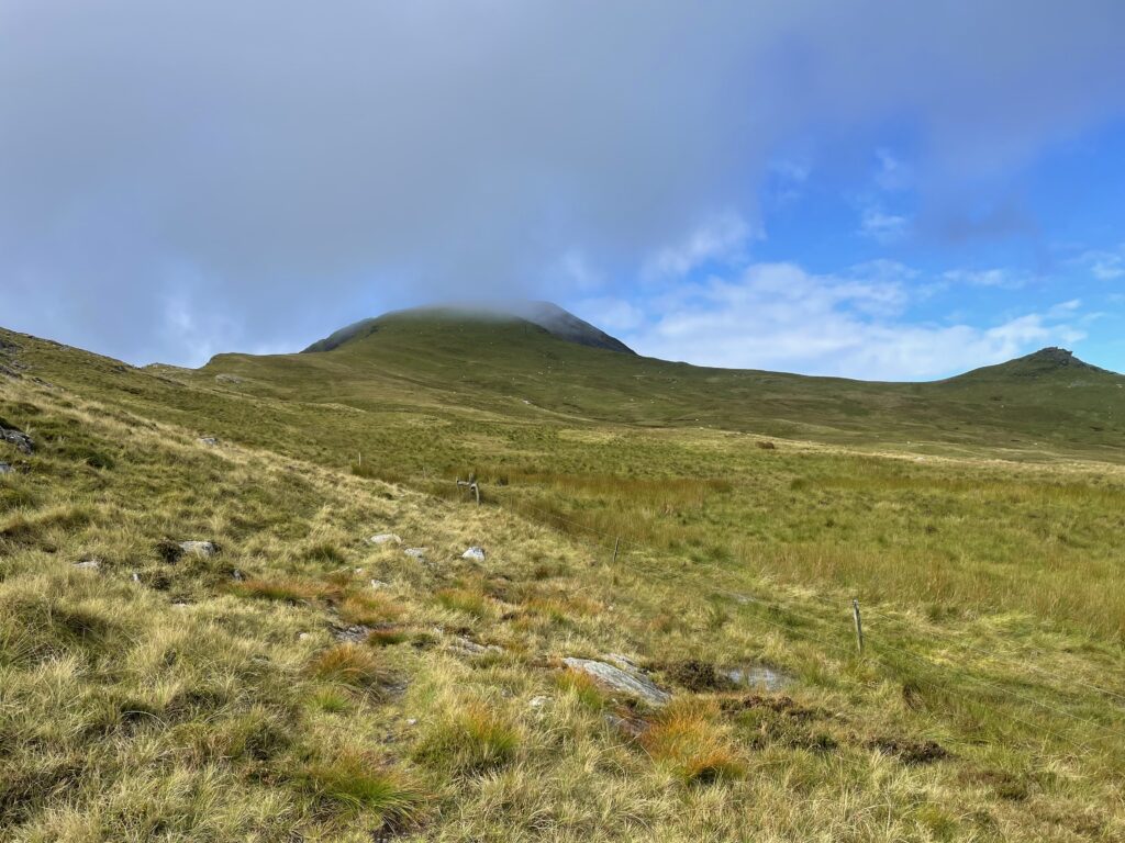
Moelwyn Mawr with cloud touching the summit


Once on summit I took the usual 360 video before setting up my station, clear of the trig point, so as not to get in the way of the runners.

360 video of the summit

And so on with the SOATA activation, I started on 2m’s using the FT65 with an external mic and the SRH770 aerial. I had the FT65 in the 3D printed stand. After self spotting on 145.400, first in the log with a S2S was M7GTU/p on Arnside Knott, G/LD-058. I had 3 more QSO’s before 2m’s dried up. This summits has good take off and I could hear lots of 2m activity as I tuned through the channels. I am sure a call on 145.500 would have generated more QSO’s if I had needed to.
I then setup on 20m’s using the telescopic 20m 1/4 wave antenna and the Icom IC705. I was expecting HF conditions to be poor after looking at the propagation forecasts earlier in the day, however the band was in reasonable shape. I had 14 QSO’s in the log on 20m’s before the callers dried up.

As I wrapped up on HF, I could see the rain moving across the valley, and so it was time to get packed away. With most of the gear packed away I had one last flick through 2m’s and just managed to catch John, G0MHF finishing up on Billinge Hill, G/SP-017 to bring the S2S count to 2. As I was logging the QSO with John the rain arrived. I was happy that I had managed to complete the activation all bar the last minute without any rain.

I descended using the same route as for the ascent, and after about an hour I was back in the car eating my dinner and drinking coffee.

The rain has arrived

Equipment Used

  • Icom IC705
  • Yaesu FT65
  • 20m telescopic 1/4 wave antenna
  • SRH770 (BNC) 2m antenna
  • 4000 mAHr LifePo4 Battery
  • PoLo logging app on iPad mini

Parking Location What3Words

///venturing.shunts.stags

Interactive Map of the route

The interactive map below shows a track of the route taken. You can zoom in or out to change the scale. The map can also be shown in full screen. The GPX track can also be downloaded using the link below the map.

Download file for GPS
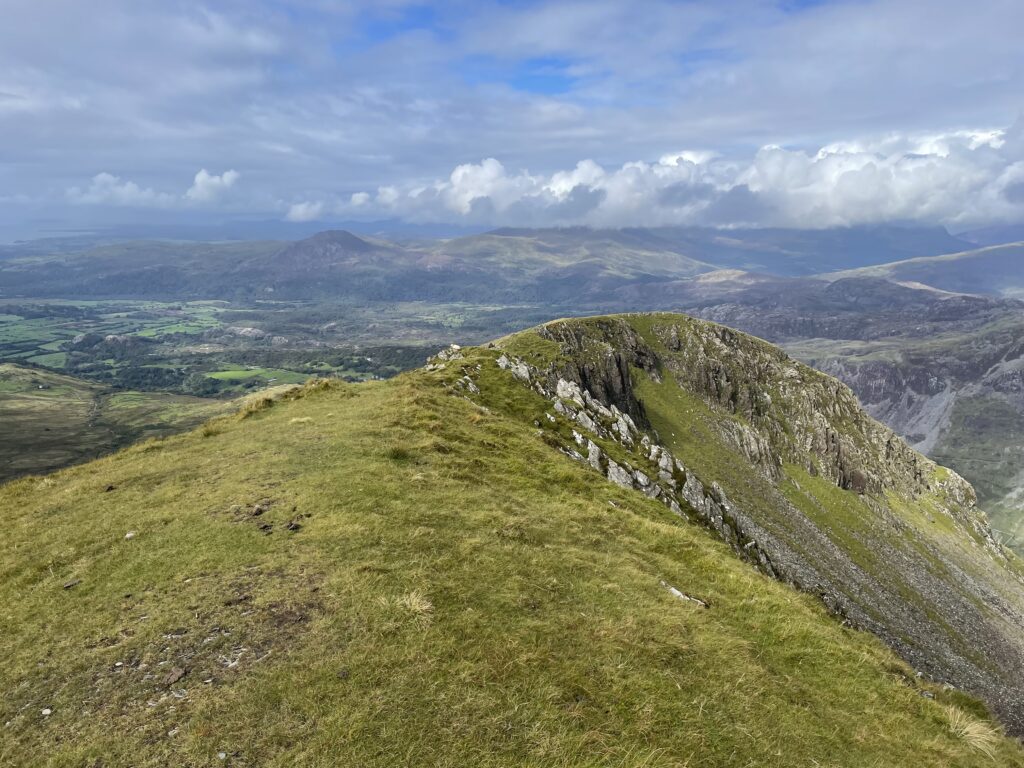
Looking down the ridge with the trig point behind me

SOTA Activation Tal y Fan GW/NW-040

Summits On The Air 4 point summit

Activity Summary

Weather

Date: 27th August 2025

Distance: 3.4 km

Ascent: 239 m

Max Altitude: 610 m

Moving time: 1:19

Total time: 3:06

Rainy

Temperature 14 ℃

Humidity 87%

Feels like 10 ℃

Wind Speed 18.1 km/h

Wind Direction SSE

Activation Summary

I was keen to get out on an activation after a couple a weeks of other commitments. However the weather seemed to have different ideas, it seems the first day I had free, was also the day the weather took a turn for the worse. The Mountain Weather forecast was showing high winds and heavy rain across Eryri (Snowdonia) for the 27th and the following days. No matter how many times I looked at the forecast, it didn’t seem to change. And so I resigned myself to the fact that if I wanted get out and play I was going to get wet.

I had been saving Tal y Fan, GW/NW-040, for the winter because it’s an easy 4 pointer, with a short walk and only 239m of ascent, but it seemed the perfect rainy day summit. Even better, as Tal y Fan is the northern most summit in Eryri (Snowdonia) national park, the mountain forecast was showing a less severe forecast than for the summits to its south, and so the decision was made.

I parked in the grassy lay-by near to the ladder style at SH73114 71468. The approach to the parking spot after leaving the main road is about 3 miles up a steep single track road. There is just enough room for 2 cars, with good ground clearance, to squeeze in without obstructing the road. It was just before 10am and I was ready and on my way.

The parking spot, you could squeeze another car with good ground clearance here

The weather was fine for most of the ascent and I thought I may even get the shelter up before the rain arrived. One thing was for sure, the rain was coming, looking South West I could see the rain moving towards me across the hills.

The rain coming toward me

As I reached the rocky outcrop near the summit the heavens opened and I was now thankful that I was wearing full waterproof gear. I took the route that goes directly over the rocks, as a I hadn’t done this route previously. In hindsight the route that goes around the rocks, as in my descent route on the map below, is much easier.

On reaching the summit the rain and wind wasn’t as bad as I was expecting although visibility was poor. After the traditional touching the trig pillar and some quick piccies, it was time to get setup.

360 video of the summit as I arrived

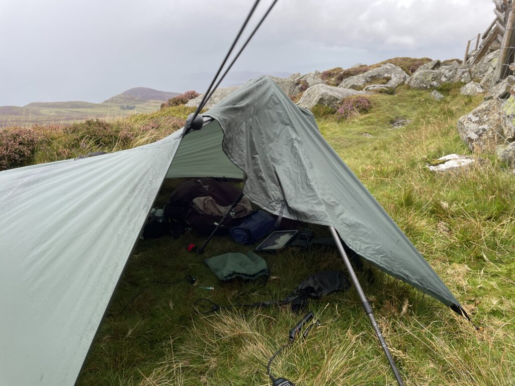
The shelter setup was nothing to be proud of, but it did the job and kept my gear dry and me from getting any wetter. I setup the 2m flowerpot antenna on the carbon 6 pole, the wind had now picked up and I struggled to lift the pole vertical, and although the pole had a worrying radius it stood upto the wind just fine.

The shack for this activation

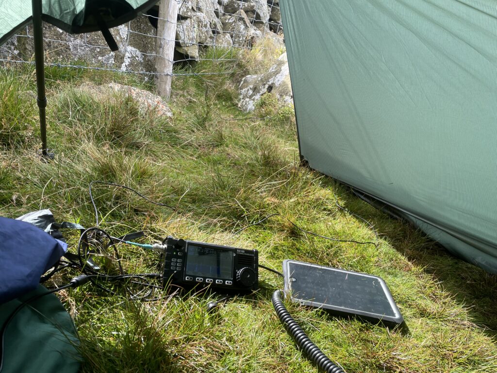
Using the FT65 with an external mic I soon had 6 in the log on 2m’s. After 2m’s had dried up I ventured out of the shelter to setup the EFHW for HF. Today I was using Xiegu x6100 for HF running 10w with an external battery. On HF I managed 13 QSO’s on 20m and 6 QSO’s on 40m with a total QSO count of 25 and 1 S2S.


As I was getting ready to pack up, the sun actually came out and the cloud cleared revealing the views. I managed to get some more pictures and get packed away before the last brief shower of the day arrived. I was soon back at the car and fortunately the waterproofs had done their job, as I had forgotten to put my dry change of clothes in the car.

360 video on the summit as I was about to pack away.

As retirement generally allows me to be a fair weather walker these days, I was pleased that SOTA and my personal goal of reaching 500 points this year, had motivated me to get out in the rain to grab another 4 points. Now to start planning the next outing.

Equipment Used

  • Xiegu x6100
  • Yaesu FT65
  • 20m EFHW antenna
  • 2m Flowerpot antenna
  • 4000 mAHr LifePo4 Battery
  • SOTA BEAMS Carbon 6 pole
  • PoLo logging app on iPad mini
  • Shelter DD-Tarps Superlight 3 x 3

Parking Location What3Words

///cherished.selling.adjuster

Interactive Map of the route

The interactive map below shows a track of the route taken. You can zoom in or out to change the scale. The map can also be shown in full screen. The GPX track can also be downloaded using the link below the map.

Download file for GPS
In shelter as the sun came out. Note the use of the wall for additional shelter

SOTA Activation Foel Offrwm GW/NW-055

Summits On The Air 1 point summit

Activity Summary

Weather

Date: 15th August 2025

Distance: 3.4 km

Ascent: 214 m

Max Altitude: 405 m

Moving time: 1:15

Total time: 2:58

Partly Cloudy

Temperature 22 ℃

Humidity 73%

Feels like 23 ℃

Wind Speed 3.8 km/h

Wind Direction NNE

Activation Summary

Foel Offrwm is a nice easy 1 point summit with great views on a clear day. I was accompanied by my wife for this activation and so hadn’t alerted for the activation in order to make for a more laid back affair. We started from the Precipice Carpark, crossing over the road and following the well signposted route. That said I manged to ignore the stone with “Foel Offrwm this way” as from memory I thought the track carried on further before veering of to the right. However after a couple of hundred metres and checking the map, it became clear that we should have taken the marked route as pointed out by wife at the time. πŸ™‚ The path meandered up the summit in a zig zag fashion and we were at the summit in less than an hour.

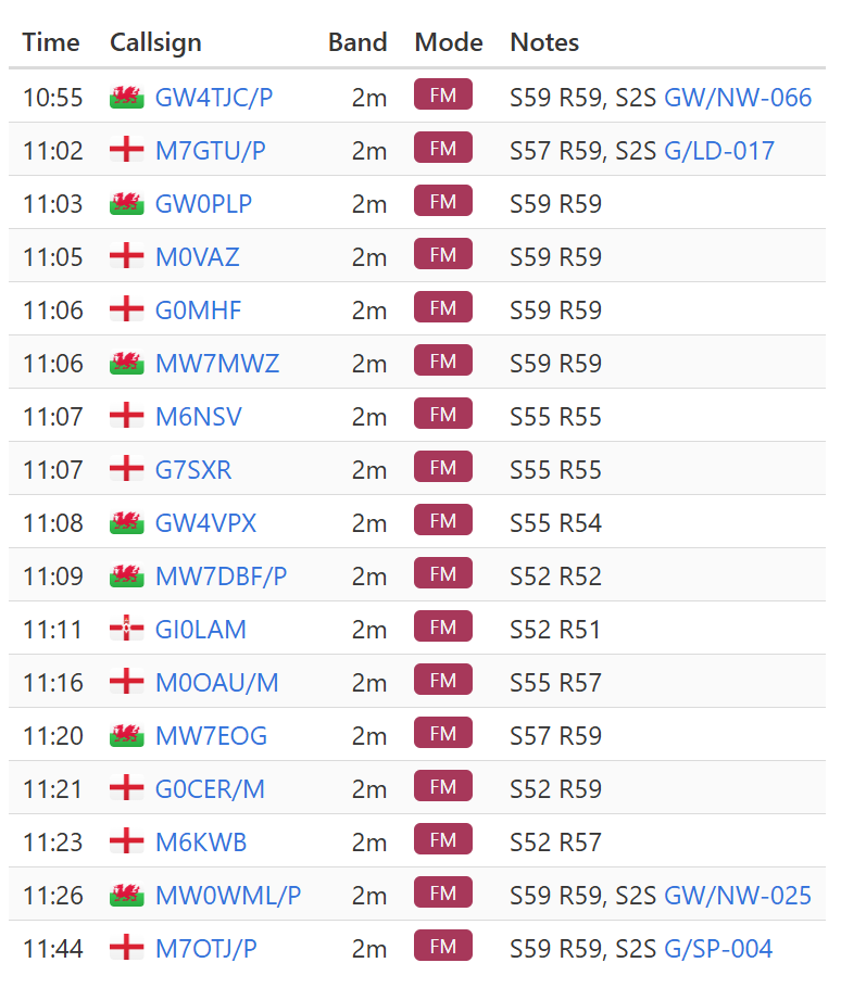
I setup up my station using my Icom Ic705 and an external 4000 mAHr LifePo4 battery. I started on 2m with the SRH770 plugged directly into the IC705 but 2m only yielded 1 QSO. I then moved onto 20m using the 1/4 wave telescopic whip. The IC705 was running 10w and in just under 10 minutes I had a further 7 QSO’s on 20m including 3 S2S’s . This gave me total count of 8 QSO’s with 3 S2S.

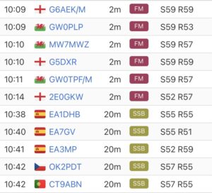
Activation Log

Equipment Used

  • Icom IC705
  • 20m 1/4 wave telescopic antenna
  • 4000 mAHr LifePo4 Battery
  • SRH770 antenna
  • PoLo logging app on iPad mini

Parking Location What3Words

///images.hikes.shuttle

Interactive Map of the route

The interactive map below shows a track of the route taken. You can zoom in or out to change the scale. The map can also be shown in full screen. The GPX track can also be downloaded using the link below the map.

Download file for GPS
360 View of the summit

SOTA Activation Y Garn GW/NW-004

Summits On The Air 8 Point summit

Activity Summary

Weather

Date: 11th August 2025

Distance: 8.6 km

Ascent: 924 m

Max Altitude: 947 m

Moving time: 3:57

Total time: 5:42

Cloudy

Temperature 18 ℃

Humidity 82%

Feels like 19 ℃

Wind Speed 2.2 km/h

Wind Direction SE

Activation Summary

I chose to hike up Y Garn as a solo summit, having recently activated the two adjacent summits of Elidir Fawr and Glyder Fawr earlier in the summer. I wanted to try this route from the Nant Peris park and ride car park, as it avoids any road walking or the need to hop on the bus. However it doesn’t seem to be a popular route and I was soon to find out why.

I started the route taking the path that starts from the side of toilet block in the Nant Peris carpark to emerge on A4086, crossing over the road and walking through the campsite in a generally NE direction. On reaching the top of the campsite and following the path through a gate, the path became somewhat obscured by ferns. From here the route starts to climb steeply. There are stiles to cross the walls/fences, although I overshot the path near the start of the climb, and had to follow the 270m contour line for about 50m through waist height ferns, in northerly direction to cross the stile. After crossing the first ladder stile the path became more defined.

This route did feel quite a slog, especially with my pack loaded with HF radio equipment and water weighing in at 11.5 kg. The ascent took about 3 hours with the gradient remaining fairly consistent until reaching the ridge at which you turn right to head for the summit of Y Garn.

On approach to the summit it became apparent that there had been a hatch of flying ants. There were large swarms and although I had applied insect repellent before setting of from the car, this did not seem to deter them. After reaching the summit I dropped down about 15m, where there was a slight breeze blowing over the edge. The breeze seemed to be enough to reduce the flying ants to a bearable level. I quickly made the decision that this was going to be a 2m only activation as the flying ants were becoming quite menacing.

I setup up my station using the Yaesu FT65 with an SRH770 antenna and after around 10 minutes I had 6 QSO’s in the log. I packed away keeping my FT65 with the stock antenna to hand. Just as I was about start the descent I saw a spot from Kevin MW0KXN on GW/NW-031 Esgeiriau Gwynion, and so managed another QSO giving me a total of 7 QSO’s, 1 S2S and 1 complete.

Equipment Used

  • Yaesu FT65
  • SRH770 antenna
  • 3D printed holder for the FT65
  • PoLo logging app on iPad mini

Parking Location – What3Words

///definite.documents.caressing

Interactive Map of the route

The interactive map below shows a track of the route taken. You can zoom in or out to change the scale. The map can also be shown in full screen. The GPX track can also be downloaded using the link below the map.

Download file for GPS
360 view from Y Garn
The View looking South toward Yr Wyddfa (Snowdon)
The View looking West toward Llanberis